A New Approach To Fishing
Join the world's most advanced AI-powered fishing prediction platform.
Trusted by leading fishing companies around the world
Predictions
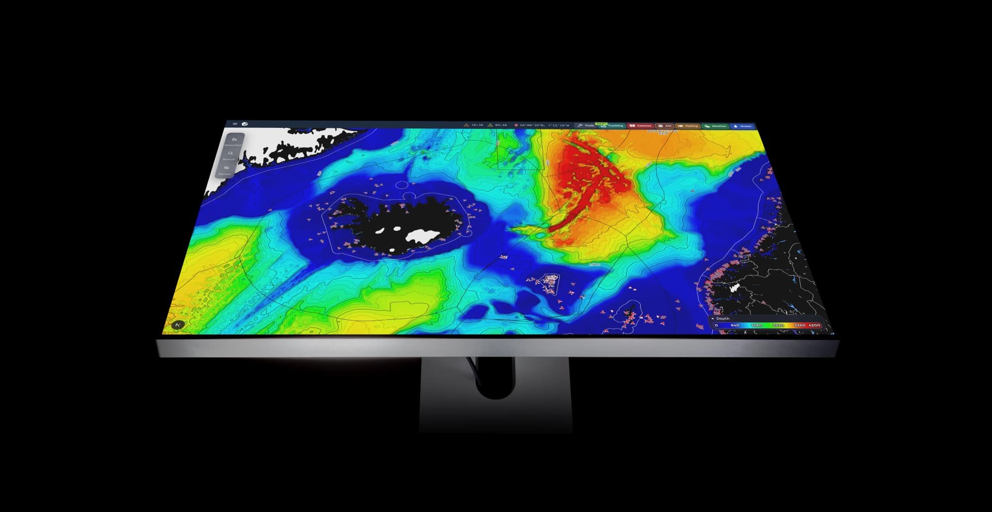
Turn your catch data into intuitive, AI-driven predictions.
GreenFish is a leader in developing and deploying AI-driven, tailor-made predictions for the fisheries sector. Each model is trained on a company's historical catch data and visualized as an easy-to-read heat map.
- Species-, fleet-, and zone-specific models tailored your operation
- Live oceanographic and weather data continuously updating the predictions
- Built on state-of-the-art HPC infrastructure
- Updated every 6 hours, up to 8 days ahead
- Put the data you already collect to use
Dynamic
Make the predictions smarter by updating them with your own data in real-time.
To make our Prediction solution even smarter, we've launched a groundbreaking new feature that allows you to report where you've recently seen or caught fish, automatically enhancing and updating the forecast.
- Dynamic predictions that adapt to every new observation you make at sea
- Add fishing activity from days or even weeks ago to strengthen prediction accuracy
- Log where you've recently spotted fish to instantly update any given prediction
Tracking
Model the movement of a fish school over any chosen timeframe from a set starting point
- Generate up to 1,000 simulations to get a better idea of possible movements
- Species-specific models and parameters which emulate the movements of schools
- Custom timeframe with start date + duration
- Real-time drift modeling using live ocean data
- Trajectory visualization for every simulated path
- Highlighted landing zone showing the most probable endpoint
- Replay & refine by adjusting parameters instantly
Everything you need, connected in one place
Predictions, live AIS-data, catch logs, oceanographic updates and everything you need for your fishing. All in one intuitive platform.
Real-time vessel tracking and monitoring with integrated AIS data. Keep a personal watchlist for the vessels you want to monitor.
Record and manage your fishing catch data with detailed logs. Track species, locations, quantities, and timestamps for comprehensive catch documentation.
Access the highest resolution satellite ocean variables at every depth from surface to bottom. Temperature, currents, chlorophyll, phytoplankton, zooplankton, sea ice, and more.
Your data is protected with enterprise-grade security measures.
Results fleets are seeing today
Every fleet measures success differently. Here's how GreenFish customers quantify the edge they get.
Better quota utilization
Maximize your catch efficiency with predictions that help you make the most of your allocated quota.
Less time at sea
Reduce search time and optimize routes with AI-driven predictions that help crews plan smarter sets.
- 1
- 2
- 3
- 4
- 5
- 6
- 7
- 8
- 9
- 10
- 11
- 12
More fuel savings
Reduce fuel consumption by optimizing routes and reducing unnecessary search time at sea.
Get in touch
Tell us a bit about you and how we can help. We'll get back to you shortly.
We work with fleets around the world — let us show you what GreenFish can do for yours.